
No products
This item added to your cart. Calculate any delivery cost at next step.
There are 0 items in your cart. There is 1 item in your cart.
The Ahwatukee area is blessed with many great wilderness preserves nearby, including some located right inside the incorporated cities within Maricopa County. All feature hiking trails to suit all fitness levels - from relatively flat strolls for casual hikes to trails guaranteed to give even the strongest a good workout.
Visitors from out of town, and even some locals, frequently ask our store staff about a few good places to go hiking, so we've put together our top 10 suggestions for good hikes that are all a short drive from central Phoenix and also have a Phoenix Trail Map section that will include these hikes and others. Some of our favorites are the trails you can hike in and around the South Mountain area:
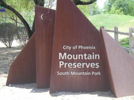
Main Entrance:
10919 S. Central Ave., 85042
Pima Canyon Entrance:
9904 S. 48th St., 85044
Ranger Office Phone: (602) 262-7393
Hours for all trailhead areas and entrances: 5 a.m. to 7 p.m. (entrance gates close). Trails remain open until 11 p.m.
At more than 16,000 acres, South Mountain Park/Preserve is often described as the largest municipal park in the country. It boasts 51 miles of primary trails for horseback riding, hiking and mountain biking for all ability levels. From the park's main entrance, you can drive up the Summit Road 5.5 miles to Dobbins Lookout and spectacular valley-wide views or you can continue to the Gila Lookout for a view of the Gila River Valley.
The primary trails include the following:
Judith Tunnell Accessible Trail
This trailhead is located at the South Mountain Environmental Education Center (SMEEC) at 10409 S. Central Ave. (Central Avenue south of Dobbins Road). There are a number of disabled accessible parking spaces at the Center. This is one of the City's newest preserve-based, barrier-free trails, consisting of two, ½-mile loops comprised of stabilized decomposed granite, providing for a smoother passage. Drinking fountains, benches, and covered ramadas are available for periodic rest stops. In order to maintain this smooth trail, bicycle and equestrian traffic are not permitted.
Distance: 1 mile, broken into two, ½ mile loops
Difficulty: The Interpretive Loop includes interpretive signs along the trail describing the plant and animal life that thrive in the area. This loop generally contains the least degree of difficulty with a moderate 7.5 % maximum grade.
The Challenge Loop consists of a slightly more difficult passage with a maximum grade of 8.5 %.
Elevation Change: Minimal
Mormon Trail
The Mormon Trailhead, located at the base of South Mountain near 24th Street and Valley View Avenue (south of Baseline Road), offers a short but challenging hike for those wanting to connect with the National Trail or Mormon Loop. From this junction, hikers may proceed east on Mormon Loop toward Pima Canyon, or south and then west on the National Trail to access Fat Man's Pass, Hidden Valley, and the Natural Tunnel.
Distance: 1.2 miles (to Mormon Loop Junction)
Difficulty: Moderate to difficult
Elevation Change: Approximately 1,000 feet.
Beverly Canyon Trail
The Beverly Canyon Trail is located in the parking lot at 8800 S. 46th St., just south of Baseline Road. The parking lot is located off the cul-de-sac at the end of the road. This trail begins from the eastern end of the parking lot near the information kiosk. This trail will have some short rocky and steep areas that cross the Pima Canyon area on the way to meeting the Desert Classic Trail on the south side of South Mountain.
Distance: 1.5 miles
Difficulty: Moderate
Elevation Change: Approximately 250 feet.
Javelina Canyon Trail
The Javelina Canyon Trail also departs from the Beverly Canyon parking area located at 8800 S. 46th St., just south of Baseline Road. This trail begins from the western end of the parking lot near the information kiosk. The trail makes a gradual climb through moderate rolling hills and will connect with the Ridgeline Trail in Pima Canyon, and will also lead to alternate connections for the Mormon Loop and National Trail.
Distance: 1.7 miles
Difficulty: Easy to moderate
Elevation Change: Approximately 440 feet.
Pima Canyon Access
Pima Canyon is located at 9904 S. 48th Street near Guadalupe Road. This area provides access to multi-use trails of various length and difficulty for hiking, mountain biking, and horseback riding. A one-mile dirt road leads to the trail head for the National Trail and other trails such as the Mormon Loop, Javelina Trail, and Ridgeline Trail. The Desert Classic Trail and East and West Loop trails are accessed from the parking lot area. The Pima Canyon area offers a map kiosk and two large shaded ramadas, complete with tables and benches, water fountains, and barbecue grills for visitor convenience. Waterless restroom facilities are also available. The trailhead parking lot is open from 5 a.m. to 7 p.m.
National Trail
The National Trail is the longest and most diverse trail in South Mountain Park. This trail is popular with hikers, mountain bike riders, and equestrian users. Although there are several locations from which to access the National Trail, Pima Canyon continues to be the primary access point. The National Trail nearly traverses the entire length of South Mountain Park. This trail offers spectacular views from the ridgeline, as well as the interior of the mountain, and will present various levels of difficulty for those willing to complete this challenging and rewarding trail.
Distance: 14.5 miles (+1 mile dirt road).
Difficulty: Moderate to difficult, depending on length of hike. Horses are not recommended beyond trail post #15 and west to Buena Vista Lookout.
Elevation Change: Approximately 1,100 feet at highest point. (Where National Trail crosses TV Tower Road near Holbert Trail)
Desert Classic Trail
The Desert Classic Trail is particularly popular with mountain bikers (but still used by hikers and equestrian users) due to its variety of technical aspects such as the semi-rough and rocky terrain, ups and downs, and wash crossings. This trail may be accessed from either of the two primary trailheads located at Pima Canyon South Ramada, and at the Desert Foothills Trailhead that accesses the Telegraph Pass Trail. The trail may also be accessed from the San Gabriel Avenue and the Warpaint Drive access areas.
Distance: 9.2 miles
Difficulty: Moderate to difficult - mainly due to the length.
Elevation Change: Approximately 100 feet.
Telegraph Pass Trail
Telegraph Pass Trailhead is located at Desert Foothills Parkway (north of Chandler Boulevard) and Seventh Street. The first ½ mile of this trail is a textured concrete surface for easy walking. The trail then splits off to continue on to Telegraph Pass, or on to The Desert Classic Trail. The remaining one mile of Telegraph Pass Trail ends at the Summit Road, and offers quick access to the National Trail and the Kiwanis Trail within the park upon reaching the roadway.
The Desert Classic Trail continues on for about 9 miles through the foothills on the south side of South Mountain and terminates at the south ramada area in Pima Canyon.
Distance: 1.5 miles to Telegraph Pass.
Difficulty: Easy to moderate - steep sections toward the top
Elevation Change: Approximately 600 feet.
Holbert Trail
Holbert Trailhead is located at the east end of the Activity Complex (first left turn immediately after entering the park on Central Avenue) and passes near Mystery Castle. This trail offers a steady climb to the upper areas of South Mountain Park. Hike the extension trail that leads to Dobbins Lookout and be rewarded with a magnificent view of the valley below. The Holbert Trail also provides a route to connect with the National Trail just east of the T.V. Towers and west of Buena Vista Lookout.
Distance: 2.5 miles
Difficulty: Difficult - fairly steep and long.
Elevation Change: Approximately 1,100 feet.
Kiwanis Trail
Kiwanis Trailhead - Just past the Ranger Station, make a left turn at the dip in the road (Central Avenue entrance), then proceed straight through the next intersection and follow the road back to a paved, split-rail fenced parking area. The Kiwanis Trail is one of the more extensively used trails inside South Mountain Park. This trail is suitable for most levels of hikers and can be used as an introduction for those wanting to get acquainted with desert mountain hiking. This trail travels through a rock-studded canyon, which is home to a variety of Sonoran Desert plants and animals, and also reveals two rock wall dams built by the Civilian Conservation Corps in the 1930's. Although, not a very long trail, it does offer direct access to the National Trail and Telegraph Pass Trail ... once you reach the roadway at the trail's end.
Distance: 1.0 mile
Difficulty: Moderate - steep towards the top end.
Elevation Change: Approximately 480 feet.
Ranger Trail
Ranger Trailhead - From the Central Avenue entrance, proceed one mile and turn left at the one mile marker. Continue on until the Five Tables picnic area is reached, then park in the paved split-railed parking area. The trail head is located at the back of Five Tables picnic area alongside an information kiosk.
The Ranger Trail provides a gradual climb through the foothills approaching the park's roadway. This trail also provides alternative routes through connections with the Derby Loop, Bajada Trail, and Las Lomitas Loop, while traveling upward to the roadway. To reach the National Trail along the ridgeline, continue across the road and climb the steep switchbacks to reach the saddle in the mountain just east of €œGoat Hill€.
Distance: 1.6 miles
Difficulty: Moderate - steep switchbacks toward the top end.
Elevation Change: Approximately 800 feet.
Los Lomitas Loop
The Los Lomitas trail section is easily accessible from both the east and west ends. From the eastern end, the trail leaves the entrance road just west of Ponderosa Stables near €œScorpion Gulch€. A trail post is visible where it leaves the road and enters the wash. From the western end, the trail departs from the Ranger Trail at about 0 .25 miles(trail post # 4) from Five Tables Trailhead. This trail is a very popular equestrian route that also connects with the Box Canyon, Hideout, and Crosscut Loop Trails. Elevation change is about 100 feet.
Distance: 2.0 miles
Difficulty: Easy to moderate-hiking the sandy washes may be challenging.
Elevation Change: Approximately 240 feet.
Bajada Trail
The Bajada Trail begins approximately 0 .50 miles up the Ranger Trail from Five Tables Trailhead (trail post # 5). This trail departs the Ranger Trail and continues west toward San Juan Valley, where the rolling foothills of South Mountain provide a great workout for all trail enthusiasts. The Bajada Trail intersects with the Max Delta Trail just inside the San Juan gate at about .9 miles, and intersects with the Alta Trail at the parking area at the San Juan Road 2.5 mile marker (additional 0.7 miles). The trail then continues approximately another 1.9 miles where it ends as it connects with the National Trail on the west end of San Juan Road.
NOTE: The entrance gate is open to motor vehicles only on the first weekend of the month from 5 a.m. to 4 p.m. and is closed indefinitely to motorized vehicles at all other times. When the road is closed, motorized vehicles may park only on the paved triangle area outside the gate and enter on foot or bicycle. Off-Road parking is not permitted.
Distance: 3.5 miles
Difficulty: Easy to moderate - although there is little elevation change, some sections and wash crossing are steep.
Elevation Change: Approximately 40 feet.
Alta Trail
The Alta Trail is considered one of the most challenging trails within South Mountain Park, but the steep climb to the ridgeline from either end rewards the hiker with a striking view of the desert landscape below. The Alta Trail begins directly across the road from the parking area, located at the 2.5 mile marker of San Juan Road. The Alta Trail also may be accessed from the west end of San Juan Road (approximately 6.0 mile marker), where the Alta Trail meets the ending of the National Trail.
NOTE: The entrance gate is open to motor vehicles only on the first weekend of the month from 5 a.m. to 4 p.m. and is closed indefinitely to motorized vehicles at all other times. When the road is closed, motorized vehicles may park only on the paved triangle area outside the gate and enter on foot or bicycle. Off-Road parking is not permitted.
Distance: 4.5 miles
Difficulty: Very difficult - very steep and loose on both ends, not recommended for horses or bikes.
Elevation Change: Approximately 1,100 feet at highest point.
Buena Vista Trailhead
Buena Vista Lookout is located approximately 6.5 miles from park entrance gate. Follow road signs and directions up the Summit Road, to Buena Vista / Hidden Valley Lookout. This paved trailhead offers limited parking spaces and is usually full during the peak seasons.This trailhead provides direct access to the National Trail at an intermediate location. From this point, traveling east, hikers can reach Fat Man's Pass in about 1.8 miles. Hiking west on the National Trail, it would be approximately 3.0 miles to reach Telegraph Pass.The Geronimo and Corona de Loma Trails are also accessible from this trailhead.
Corona de Loma Trail
This trail begins on the southwestern edge of the Buena Vista Trailhead parking area near National Trail post #21. This trail descends the south side of the mountain through washes and steep switchbacks to reach the Desert Classic Trail.
Distance: 2.3 miles to Desert Classic
Difficulty: Moderate-Steep switchbacks
Elevation Change: Approximately 880 feet.
Geronimo Trail
This trail begins on the north edge of the Buena Vista Trailhead approximately .25 miles from the path leading to the memorial bench. This trail descends down the north side of the mountain, skirting the Heard Scout Pueblo before ending near 20th Street and Dobbins Road. This trail is very popular with mountain bicycle riders for the moderate downhill descent.
Distance: 2.5 miles.
Difficulty: Moderate.
Elevation Change: Approximately 1,000 feet.
Do consider the extreme weather potential before heading out on a hike here around South Mountain or anywhere in the Ahwatukee area, especially if you are a first-time visitor. The best time to hike is October through April when temperatures are moderate or even cool in places. Between May and September though, it can be brutally hot, so head out at sunrise before things really get cooking!
Either way, make sure you're properly outfitted with the right shoes, hiking socks, snacks, day packs and other hiking gear before your next outdoor adventure. Just stop by LowerGear - your local outdoors supplier in Tempe, easily reached near the intersection of 101 and 202 east of the ASU campus.
South Mountain is just one of our top 10 favorite hiking spots in the Ahwatukee area. We have trail and hiking information on the other 9 at the links below (with their general location vicinity). Click on the listing for more information on that hiking area.
Camelback Mountain (north-central Phoenix)
Piestawa Peak (north-central Phoenix)
Dreamy Draw (north-central Phoenix)
Usery Mountain (east Mesa)
Estrella Mountains (west Phoenix / Goodyear)
Cave Creek Regional Park (north Phoenix / Cave Creek)
Papago Park (east Phoenix / southwest Scottsdale)
Lost Dog Wash (north-east Scottsdale)
McDowell Mountain Regional Park (north-east Scottsdale)